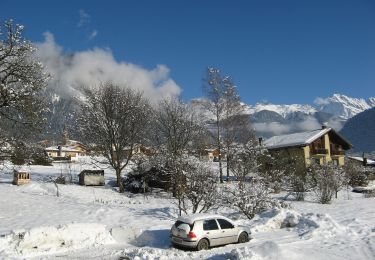
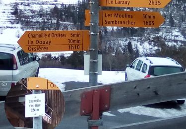
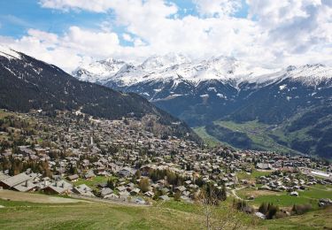
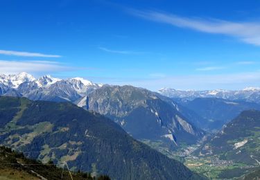
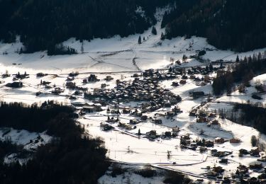
Trail Walking Val de Bagnes - Le Tour des Villages - Photo
 verbier
verbier

User

© OpenStreetMap contributors
Length
Length
18 km
Max alt
Max alt
1344 m
Uphill gradient
Uphill gradient
845 m
Km-Effort
Km-Effort  
29 km
Min alt
Min alt
821 m
Downhill gradient
Downhill gradient
839 m
Boucle
Boucle
Yes
Creation date :
2014-12-10 00:00:00.0
Updated on :
2014-12-10 00:00:00.0

(0 Reviews)

Walking
Walking
6h00
Difficulty : Unknown

Scan this QR Code to open this trail in the SityTrail application

FREE GPS app for hiking

Logo SityTrail SityTrail

IGN / Geographical institutes

Download SityTrail from the App Store Download SityTrail from Google Play

Logo SityTrail SityTrail World

The world is yours!

Download SityTrail from the App Store Download SityTrail from Google Play Download SityTrail on Huawei AppGallery

About

Trail Walking of 18 km to be discovered at Valais/Wallis, Entremont, Val de Bagnes. This trail is proposed by verbier.

Description

Für die Tour durch die Dörfer braucht man einen guten Tag. Sie ist bestens mar-kiert und folgt friedlichen landwirtschaftlichen Wegen. Von Le Châble (821 m) steigt man am Bergbach nach Cotterg auf. Mitten im Weiler zweigt man nach rechts ab auf das landwirtschaftliche Strässchen nach Fon-tenelle-dessus. Der steile Weg wird gegen Chapelle des Vernays (1108 m) etwas flacher; man verlässt ihn, um auf einem Waldweg weiter zu wan-dern, der sich zur Forststrasse von Diableys hinaufschlängelt. Diese steigt zu einer Kreuzung mit einer befahrbaren Strasse beim Weiler Les Ires an (1310 m). Jetzt folgt ein Abstieg bis ins Dorf von Sarreyer (1229 m), von wo der landwirtschaftliche Weg unterhalb der Strasse weiter zu den kleinen Weilern Planchamp, Morgnes und Lourtier (1088 m) führt. Die Wan-derung geht am linken Ufer nach Rosay und danach hinunter nach Champsec (901 m) weiter. Jetzt steigt man wieder auf zur Bruson-Hochebene über den Cône de Versegères, ü-berquert den Wildbach, in einen der seltenen Bächern, der nicht für die Energie-produktion genutzt wird, und zweigt nach rechts ab. Das Bruson-Plateau überqueren bis zum Dorf (1042 m). Beim Abstieg nach Le Châble vermeidet man die zahlreichen Kreuzungen mit der befahrbaren Strasse, indem man gleich zu Beginn den Wildbach Seudxay durchquert.
Eine 2-tägige Variante sieht eine Übernachtung im Hôtel de la Vallée in Lour-tier vor.

Elevation profile

Points of interest

Point of interest Val de Bagnes - Place du village - Photo
verbier
VAL DE BAGNES 
Point of interest Val de Bagnes -  - Photo
verbier
VAL DE BAGNES 
Point of interest Val de Bagnes - Eglise paroissiale et musée de Bagnes - Photo
verbier
Point of interest Val de Bagnes - Musée de la pierre ollaire - Photo
verbier
Point of interest Val de Bagnes - La Forge Oreiller - Photo
verbier
VAL DE BAGNES 
Point of interest Val de Bagnes - Hôtel La Vallée - Photo
verbier
VAL DE BAGNES 

Positioning

Country:
Switzerland
Region :
Valais/Wallis
Department/Province :
Entremont
Municipality :
Val de Bagnes
Location:
Unknown
Start:(UTM)
361699 ; 5104496 (32T) N.

Trails nearby

Trail On foot Val de Bagnes - Vollèges - Levron - Photo
On foot
GUIDE+

On foot

Easy
Val de Bagnes, Valais/Wallis, Entremont, Switzerland
3.3 km | 7.8 km-effort
1h 46min
No
Trail On foot Val de Bagnes - Vollèges - Levron - Photo
On foot
GUIDE+

On foot

Easy
Val de Bagnes, Valais/Wallis, Entremont, Switzerland
5.4 km | 10.3 km-effort
2h 20min
No
Trail On foot Orsières - Chemins pédestre, commune d'Orsières - Photo
On foot
GUIDE+

On foot

Easy
Orsières, Valais/Wallis, Entremont, Switzerland
5.4 km | 14.1 km-effort
3h 12min
No
Trail On foot Val de Bagnes - Ancien Bisse du Levron - Photo
On foot
GUIDE+

On foot

Easy
Val de Bagnes, Valais/Wallis, Entremont, Switzerland
10.7 km | 13.4 km-effort
3h 2min
No
Trail Walking Val de Bagnes - La Haute Route : J2 - Photo
Walking
Greg813

Walking

Difficult
Val de Bagnes, Valais/Wallis, Entremont, Switzerland
12.4 km | 21 km-effort
3h 37min
No
Trail On foot Val de Bagnes - Promenade de la Dranse - Photo
On foot
GUIDE+

On foot

Easy
Val de Bagnes, Valais/Wallis, Entremont, Switzerland
7.1 km | 9.4 km-effort
2h 8min
No
Trail On foot Val de Bagnes - Chemins pédestres, région Bagnes - Photo
On foot
GUIDE+

On foot

Easy
Val de Bagnes, Valais/Wallis, Entremont, Switzerland
6.2 km | 15 km-effort
3h 24min
No
Trail On foot Val de Bagnes - Bruson - Moay - Photo
On foot
GUIDE+

On foot

Easy
Val de Bagnes, Valais/Wallis, Entremont, Switzerland
3.6 km | 10 km-effort
2h 16min
No
Trail Walking Riddes - Croix de Coeur - Pierre Avoi - Photo
Walking
jptritten

Walking

Medium
(2)
Riddes, Valais/Wallis, Martigny, Switzerland
6.4 km | 10.9 km-effort
2h 26min
Yes


Close
My subscriptions